And while the implementation of the new Urban Wastewater Treatment Directive, which now applies to many areas, including smaller settlements with at least 1,000 inhabitants, is underway, the Joint Research Center (JRC) published the Climate Action Progress Report 2024.
Although the EU is on the right track, it still has a lot of work to do, especially in the field of monitoring. The directives are in place, however, implementation is the far more difficult part. Incomparably more difficult.
To help raise this issue, SeaCras periodically publishes data and studies to raise awareness and promote open science and open data policies, so that the general public has more easily accessible data when it comes to pollution detection.
Our system continuously monitors and detects pollution, as well as incidents that fall outside the ‘classic’ definition of an incident. For example, we’re talking about construction sites on the very coast of cities and other populated settlements.
One such example is the application of our AI technology for analysing high-resolution satellite images, which helped us detect a series of abnormal changes in the sea quality status in Zadar area.
Figures 1 to 4, show quantitative results of analysis using our AI algorithms.
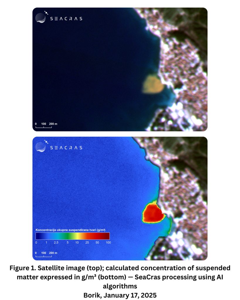

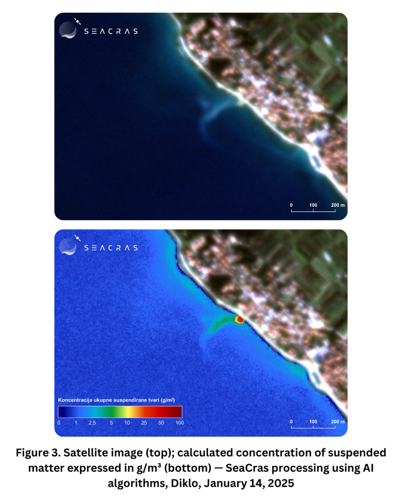
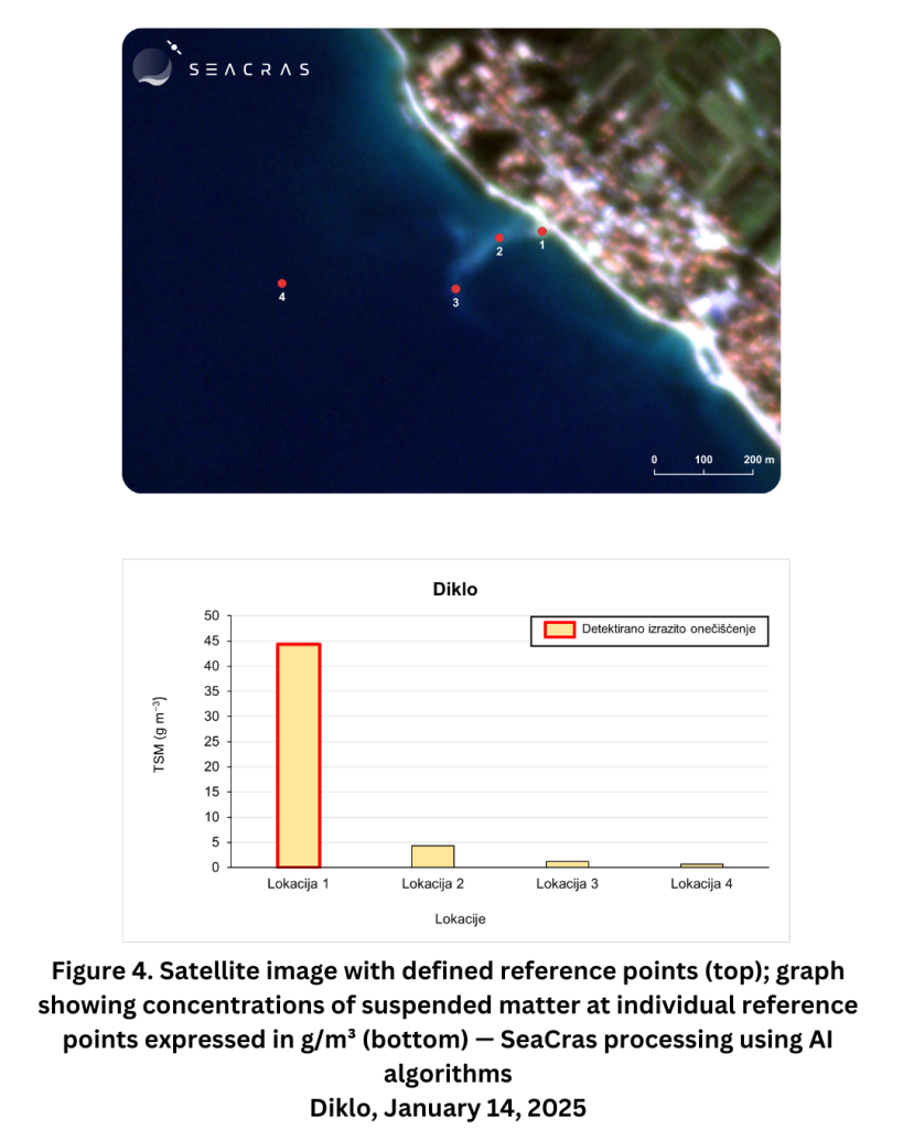
The detected occurrences spatially correlate with locations where infrastructural works are being carried out on maritime property. What we’re observing is turbidity, whose intensity we calculated using our technology and defined by descriptor D7 — the concentration of total suspended matter in the water column.
The phenomenon is of high intensity and widespread spatial extent. In some cases, the concentration of suspended matter is more than 50 times higher than normal levels.
Therefore, as we’ve shown in the examples above, it’s extremely important to deploy efficient monitoring systems and continuous water pollution detection in urbanised areas along the coastline.